
Actinia Quickstart
Actinia is an open source REST API for scalable, distributed, high performance processing of geographical data that uses GRASS GIS for computational tasks. Actinia provides a REST API to process satellite images, time series of satellite images, raster and vector data.
Contents
- Actinia Quickstart
- Quick tour
- Introduction to ace - actinia command execution
- Requirements and setup
- List locations, mapsets and maps
- Acessing maps in a different mapset
- Job management
- Inspecting the REST call prior to submission
- Available export formats
- Displaying a map - map rendering
- Examples for ephemeral processing
- Command line examples
- Script examples
- Creation of new locations
- Installing of GRASS GIS addons (extensions)
- Further reading
Quick tour
To run actinia on OSGeoLive, you will send HTTP GET, PUT, POST and DELETE requests to the actinia server.
Sample query with curl
Example: query of actinia version on OSGeoLive actinia server:
curl -u actinia-gdi:actinia-gdi 'http://localhost:8088/api/v1/version'
Data management example
- List all locations that are available in the actinia persistent database:
curl -X GET "http://localhost:8088/api/v1/locations" -H "authorization: Basic …"
- List all mapsets in the location LL:
curl -X GET "https://actinia.mundialis.de/api/v1/locations/LL/mapsets" -H "authorization: Basic …"
- List all space-time raster datasets (STRDS) in location LL and mapset Sentinel_timeseries:
curl -X GET "https://actinia.mundialis.de/api/v1/locations/LL/mapsets/Sentinel_timeseries/strds" -H "authorization: Basic …"
- List all raster map layers of the STRDS:
curl -X GET "https://actinia.mundialis.de/api/v1/locations/LL/mapsets/Sentinel_timeseries/strds/S2A_B04/raster_layers" -H "authorization: Basic …"
Landsat and Sentinel-2 NDVI computation example
- Compute the NDVI of the top of athmosphere (TOAR) corrected Landsat4 scene LC80440342016259LGN00:
curl -X POST "https://actinia.mundialis.de/api/v1/landsat_process/LC80440342016259LGN00/TOAR/NDVI" -H "authorization: Basic …"
- NDVI computation of Sentinel-2A scene S2A_MSIL1C_20170212T104141_N0204_R008_T31TGJ_20170212T104138:
curl -X POST "https://actinia.mundialis.de/api/v1/sentinel2_process/ndvi/S2A_MSIL1C_20170212T104141_N0204_R008_T31TGJ_20170212T104138" -H "authorization: Basic …"
The results of the asynchronous computations are available as GeoTIFF file in a cloud storage for download.
Ways to use actinia
Providing a REST API, actinia can be used in different ways:
- curl or similar command line tools
- the Postman extension for browsers
- open a GRASS GIS session and use the ace (actinia command execution) tool
- other interfaces to REST API
In this quickstart, we make use of GRASS GIS to conveniently launch commands from the session to the actinia server (which itself uses GRASS GIS). The idea is to rapidly develop a workflow locally on small data sets to then execute it on the server.
Introduction to ace - actinia command execution
The ace tool (details)
allows the execution of a single GRASS GIS command or a
list of GRASS GIS commands on an actinia REST service
(https://actinia.mundialis.de/). In addition it provides job management,
the ability to list locations, mapsets and map layer the user has access
to as well as the creation and deletion of mapsets.
Th ace tool must be executed in an active GRASS GIS session and will
use the current location of this session to access the actinia service.
The current location setting can be overridden by the
--location LOCATION_NAME option. All commands will be executed per
default in an ephemeral database. Hence, generated output must be
exported using augmented GRASS commands.
The option --persistent MAPSET_NAME allows the execution of commands
in the persistent user database. It can be used with
--location LOCATION_NAMEoption.
Requirements and setup
Needed Python libraries
In case not yet present on the system, the following Python libraries are needed:
pip3 install requests simplejson click
Authentication settings
The user must setup the following environmental variables to specify the actinia server and credentials:
# set credentials and REST server URL
export ACTINIA_USER='demouser'
export ACTINIA_PASSWORD='gu3st!pa55w0rd'
export ACTINIA_URL='https://actinia.mundialis.de/latest'
Notes on the usage of external data sources
GRASS GIS commands can be augmented with actinia specific extensions.
The + operator can be specified for an input parameter to import a
web located resource and to specify the export of an output parameter.
See Example 1 and other examples below.
Available data
Importantly, the name of the local location and mapset must correspond to that on the actinia REST server.
Currently available datasets are (organized by projections):
- North Carolina sample dataset (NC State-Plane metric CRS, EPSG:
3358):
- base cartography (
nc_spm_08/PERMANENT; source: https://grassbook.org/datasets/datasets-3rd-edition/) - Landsat subscenes (
nc_spm_08/landsat; source: https://grass.osgeo.org/download/sample-data/)
- base cartography (
- Latitude-Longitude location (LatLong WGS84, EPSG:4326):
- empty (
latlong/PERMANENT/) - 16-days NDVI, MOD13C1, V006, CMG 0.05 deg res.
(
latlong/modis_ndvi_global/; source: https://lpdaac.usgs.gov/dataset_discovery/modis/modis_products_table/mod13c1_v006) - LST growing degree days asia 2017 (
latlong/asia_gdd_2017/; source: https://www.mundialis.de/en/temperature-data/) - LST tropical days asia 2017 (
latlong/asia_tropical_2017/) - LST temperature daily asia 2017, including min, max and avg
(
latlong/asia_lst_daily_2017/)
- empty (
- Europe (EU LAEA CRS, EPSG:3035):
- EU DEM 25m V1.1 (
eu_laea/PERMANENT/; source: https://land.copernicus.eu/imagery-in-situ/eu-dem) - CORINE Landcover 2012, g100_clc12_V18_5 (
eu_laea/corine_2012/; source: https://land.copernicus.eu/pan-european/corine-land-cover/clc-2012)
- EU DEM 25m V1.1 (
- World Mollweide (EPSG 54009):
- GHS_POP_GPW42015_GLOBE_R2015A_54009_250_v1_0
(
world_mollweide/pop_jrc; source: https://ghsl.jrc.ec.europa.eu/ghs_pop.php)
- GHS_POP_GPW42015_GLOBE_R2015A_54009_250_v1_0
(
Note that only selected datasets are available to the demo user (access is managed on a per-user base).
List locations, mapsets and maps
In order to list the locations the user has access to, run
ace --list-locations
['latlong', 'nc_spm_08', 'utm_32n', 'latlong']
The following command lists mapsets of current location in the active GRASS GIS session (nc_spm_08):
# running ace in the "nc_spm_08" location:
ace --list-mapsets
['PERMANENT', 'landsat']
All following commands can be executed in any active GRASS GIS location, since the location name at the actinia server is explicitly provided. In case the location option is not provided, the active location will be used. The following command lists mapsets of the provided location latlong:
ace --location latlong --list-mapsets
['PERMANENT']
To list all raster maps available in the specified mapset belonging to the provided location latlong, run:
ace --location latlong --list-raster PERMANENT
['dem_gmted', 'hwsd_stghws1a', 'lulc_globc']
To list all vector maps available in the specified mapset belonging to the current or a provided location, run:
ace --location latlong --list-vector PERMANENT
['world_countries']
List all raster maps in a location/mapset different from the current session location:
ace --location nc_spm_08 --list-raster PERMANENT

['aspect',
 'basin_50K',
 'boundary_county_500m',
 'cfactorbare_1m',
 'cfactorgrow_1m',
 'el_D782_6m',
 'el_D783_6m',
 'el_D792_6m',
 'el_D793_6m',
 'elev_lid792_1m',
 'elev_ned_30m',
 ...
 'lsat7_2002_70',
 'lsat7_2002_80',
 'ncmask_500m',
 'ortho_2001_t792_1m',
 'roadsmajor',
 'slope',
 'soilsID',
 'soils_Kfactor',
 'streams_derived',
 'towns',
 'urban',
 'zipcodes',
 'zipcodes_dbl']
Acessing maps in a different mapset
Simply use @name_of_mapset.
Job management
The ace tool can list jobs, choose from all, accepted,
running, terminated, finished, error.
Show finished job(s) (note: the actual response may differ):
ace --list-jobs finished

resource_id-7a94b416-6f19-40c0-96c2-e62ce133ff89 finished 2018-12-17 11:33:58.965602
resource_id-87965ced-7242-43d2-b6da-5ded47b10702 finished 2018-12-18 08:45:29.959495
resource_id-b633740f-e0c5-4549-a663-9d58f9499531 finished 2018-12-18 08:52:36.669777
resource_id-0f9d6382-b8d2-4ff8-b41f-9b16e4d6bfe2 finished 2018-12-17 11:14:00.283710
Show running job(s):
ace --list-jobs running
resource_id-30fff8d6-5294-4f03-a2f9-fd7c857bf153 running 2018-12-18 21:58:04.107389
Show details about a specific job:
ace --info-job resource_id-30fff8d6-5294-4f03-a2f9-fd7c857bf153

{'accept_datetime': '2018-12-18 21:47:41.094534',
 'accept_timestamp': 1545169661.0945334,
 'api_info': {'endpoint': 'asyncephemeralexportresource',
              'method': 'POST',
              'path': '/api/v1/locations/latlong/processing_async_export',
              'request_url': 'http://actinia.mundialis.de/api/v1/locations/latlong/processing_async_export'},
 'datetime': '2018-12-18 21:58:14.133485',
 'http_code': 200,
 'message': 'Running executable v.rast.stats with parameters '
            "['map=canada_provinces', 'layer=1', 'raster=srtmgl ... "
            "average,range,stddev,percentile', 'percentile=95'] for 631.702 "
            'seconds',
 'process_chain_list': [],
 'progress': {'num_of_steps': 5, 'step': 5},
 'resource_id': 'resource_id-30fff8d6-5294-4f03-a2f9-fd7c857bf153',
 'status': 'running',
 'time_delta': 633.0389630794525,
 'timestamp': 1545170294.1334834,
 'urls': {'resources': [],
          'status': 'https://actinia.mundialis.de/api/v1/resources/markus/resource_id-30fff8d6-5294-4f03-a2f9-fd7c857bf153'},
 'user_id': 'markus'}
Inspecting the REST call prior to submission
To generate the actinia process chain JSON request simply add the –dry-run flag:
ace --dry-run r.slope.aspect elevation=elevation slope=myslope
which will deliver the output:
{
  "version": "1",
  "list": [
    {
      "module": "r.slope.aspect",
      "id": "r.slope.aspect_1804289383",
      "inputs": [
        {
          "param": "elevation",
          "value": "elevation"
        },
        {
          "param": "format",
          "value": "degrees"
        },
        {
          "param": "precision",
          "value": "FCELL"
        },
        {
          "param": "zscale",
          "value": "1.0"
        },
        {
          "param": "min_slope",
          "value": "0.0"
        }
      ],
      "outputs": [
        {
          "param": "slope",
          "value": "myslope"
        }
      ]
    }
  ]
}
Available export formats
At time the following export formats are currently supported:
- raster:
GTiff - vector:
ESRI_Shapefile,GeoJSON,GML - table:
CSV,TXT
The vector formats will be extended in future versions of actina with Geopackage and SQLite formats.
Displaying a map - map rendering
It is very easy (and fast) to render a map:
# check amount of pixels, just FYI
ace --location latlong r.info globcover@globcover
ace --location latlong --render-raster globcover@globcover
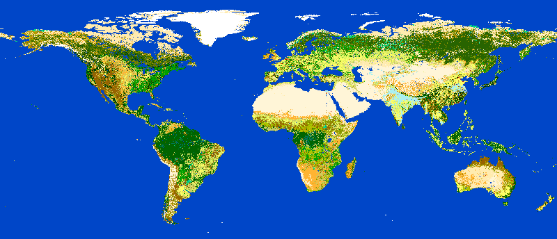
ESA Globcover map shown by actinia
Examples for ephemeral processing
Ephemeral processing is the default processing approach of actinia. Each single command or all commands in a shell script, will be executed in an ephemeral mapset. This mapset will be removed after processing. The output of GRASS GIS modules can be marked for export, to store the computational result for download and further analysis.
Command line examples
Run the module g.list in the location defined by the active GRASS
GIS session in an ephemeral mapset, that has only the PERMANENT mapset
in its search path:
ace g.list raster

Resource status accepted
Polling: https://actinia.mundialis.de/api/v1/resources/demouser/resource_id-db96cd83-dbc2-40c6-b550-20e265e51c1b
Resource poll status: finished
Processing successfully finished
Resource status finished
--------------------------------------------------------------------------
aspect
basin_50K
boundary_county_500m
cfactorbare_1m
cfactorgrow_1m
el_D782_6m
el_D783_6m
el_D792_6m
el_D793_6m
elev_lid792_1m
elev_ned_30m
elev_srtm_30m
elev_state_500m
elevation
elevation_shade
facility
geology_30m
lakes
landclass96
landcover_1m
landuse96_28m
lsat7_2002_10
lsat7_2002_20
lsat7_2002_30
lsat7_2002_40
lsat7_2002_50
lsat7_2002_61
lsat7_2002_62
lsat7_2002_70
lsat7_2002_80
ncmask_500m
ortho_2001_t792_1m
roadsmajor
slope
soilsID
soils_Kfactor
streams_derived
towns
urban
zipcodes
zipcodes_dbl

{'resources': [],
 'status': 'https://actinia.mundialis.de/api/v1/resources/demouser/resource_id-db96cd83-dbc2-40c6-b550-20e265e51c1b'}
Run the module g.region in a new ephemeral location, to show the
default region of a temporary mapset:
ace g.region -p

Resource status accepted
Polling: https://actinia.mundialis.de/api/v1/resources/demouser/resource_id-b398b4dd-a47c-4443-a07d-7814cc737973
Resource poll status: finished
Processing successfully finished
Resource status finished
--------------------------------------------------------------------------
projection: 99 (Lambert Conformal Conic)
zone:       0
datum:      nad83
ellipsoid:  a=6378137 es=0.006694380022900787
north:      320000
south:      10000
west:       120000
east:       935000
nsres:      500
ewres:      500
rows:       620
cols:       1630
cells:      1010600

{'resources': [],
 'status': 'https://actinia.mundialis.de/api/v1/resources/demouser/resource_id-b398b4dd-a47c-4443-a07d-7814cc737973'}
Script examples
Example 1: computing slope and aspect and univariate statistics from an elevation model
The following commands (to be stored in a script and executed with
ace) will import a raster layer from an internet source as raster
map elev, sets the computational region to the map and computes the
slope. Additional information about the raster layer are requested with
r.info.
Store the following script as text file ace_dtm_statistics.sh:
# grass77 ~/grassdata/nc_spm_08/user1/
# Import the web resource and set the region to the imported map
g.region raster=elev+https://storage.googleapis.com/graas-geodata/elev_ned_30m.tif -ap
# Compute univariate statistics
r.univar map=elev
r.info elev
# Compute the slope of the imported map and mark it for export as geotiff file
r.slope.aspect elevation=elev slope=slope_elev+GTiff
r.info slope_elev
Save the script in the text file to /tmp/ace_dtm_statistics.sh and
run the saved script as
ace --script /tmp/ace_dtm_statistics.sh
The results are provided as REST resources.
To generate the actinia process chain JSON request simply add the –dry-run flag
ace --dry-run --script /tmp/ace_dtm_statistics.sh
The output should look like this:
{
  "version": "1",
  "list": [
    {
      "module": "g.region",
      "id": "g.region_1804289383",
      "flags": "pa",
      "inputs": [
        {
          "import_descr": {
            "source": "https://storage.googleapis.com/graas-geodata/elev_ned_30m.tif",
            "type": "raster"
          },
          "param": "raster", "value": "elev"
        }
      ]
    },
    {
      "module": "r.univar",
      "id": "r.univar_1804289383",
      "inputs": [
        {"param": "map", "value": "elev"},
        {"param": "percentile", "value": "90"},
        {"param": "separator", "value": "pipe"}
      ]
    },
    {
      "module": "r.info",
      "id": "r.info_1804289383",
      "inputs": [{"param": "map", "value": "elev"}]
    },
    {
      "module": "r.slope.aspect",
      "id": "r.slope.aspect_1804289383",
      "inputs": [
        {"param": "elevation", "value": "elev"},
        {"param": "format", "value": "degrees"},
        {"param": "precision", "value": "FCELL"},
        {"param": "zscale", "value": "1.0"},
        {"param": "min_slope", "value": "0.0"}
      ],
      "outputs": [
        {
          "export": {"format": "GTiff", "type": "raster"},
          "param": "slope", "value": "slope_elev"
        }
      ]
    },
    {
      "module": "r.info",
      "id": "r.info_1804289383",
      "inputs": [{"param": "map", "value": "slope_elev"}]
    }
  ]
}
Example 2: Orthophoto image segmentation with export
Store the following script as text file /tmp/ace_segmentation.sh:
# grass77 ~/grassdata/nc_spm_08/user1/
# Import the web resource and set the region to the imported map
# we apply a trick for the import of multi-band GeoTIFFs:
# install with: g.extension importer
importer raster=ortho2010+https://apps.mundialis.de/workshops/osgeo_ireland2017/north_carolina/ortho2010_t792_subset_20cm.tif
# The importer has created three new raster maps, one for each band in the geotiff file
# stored them in an image group
r.info map=ortho2010.1
r.info map=ortho2010.2
r.info map=ortho2010.3
# Set the region and resolution
g.region raster=ortho2010.1 res=1 -p
# Note: the RGB bands are organized as a group
i.segment group=ortho2010 threshold=0.25 output=ortho2010_segment_25+GTiff goodness=ortho2010_seg_25_fit+GTiff
# Finally vectorize segments with r.to.vect and export as a GeoJSON file
r.to.vect input=ortho2010_segment_25 type=area output=ortho2010_segment_25+GeoJSON
Run the script saved in a text file as
ace --script /tmp/ace_segmentation.sh
The results are provided as REST resources.
Examples for persistent processing
GRASS GIS commands can be executed in a user specific persistent
database. The user must create a mapset in an existing location. This
mapsets can be accessed via ace. All processing results of commands
run in this mapset, will be stored persistently. Be aware that the
processing will be performed in an ephemeral database that will be moved
to the persistent storage using the correct name after processing.
To create a new mapset in the nc_spm_08 location with the name test_mapset the following command must be executed
ace --location nc_spm_08 --create-mapset test_mapset
Run the commands from the statistic script in the new persistent mapset
ace --location nc_spm_08 --persistent test_mapset --script /path/to/ace_dtm_statistics.sh
Show all raster maps that have been created with the script in test_mapset
ace --location nc_spm_08 --persistent test_mapset g.list type=raster mapset=test_mapset
Show information about raster map elev and slope_elev
ace --location nc_spm_08 --persistent test_mapset r.info elev@test_mapset
ace --location nc_spm_08 --persistent test_mapset r.info slope_elev@test_mapset
Delete the test_mapset
ace --location nc_spm_08 --delete-mapset test_mapset
If the active GRASS GIS session has identical location/mapset settings, then an alias can be used to avoid the persistent option in each single command call:
alias acp="ace --persistent `g.mapset -p`"
We assume that in the active GRASS GIS session the current location is nc_spm_08 and the current mapset is test_mapset. Then the commands from above can be executed in the following way:
ace --create-mapset test_mapset
acp --script /path/to/ace_dtm_statistics.sh
acp g.list type=raster mapset=test_mapset
acp r.info elev@test_mapset
acp r.info slope_elev@test_mapset
Creation of new locations
# create new location
ace --create-location latlon 4326
# create new mapset within location
ace --location latlon --create-mapset user1
Installing of GRASS GIS addons (extensions)
# list existing addons, see also
# https://grass.osgeo.org/grass7/manuals/addons/
ace --location latlon g.extension -l

# install machine learning addon r.learn.ml
ace --location latlon g.extension r.learn.ml
Further reading
- Visit the actinia website at https://actinia.mundialis.de
- Neteler, M., Gebbert, S., Tawalika, C., Bettge, A., Benelcadi, H., Löw, F., Adams, T, Paulsen, H. (2019). Actinia: cloud based geoprocessing. In Proc. of the 2019 conference on Big Data from Space (BiDS‘2019) (pp. 41–44). EUR 29660 EN, Publications Office of the European Union 5, Luxembourg: P. Soille, S. Loekken, and S. Albani (Eds.). (DOI)