52°North - exploring horizons - logo

52°North SOS Quickstart

Getting Started

The 52°North SOS is a web service, that allows you to provide and collect spatial sensor data (including metadata and measurements/observations).

  1. Go to Geospatial ‣ Web Services ‣ Start 52North SOS to start the 52°North SOS or use this direct link.
(If the service is not reachable, try to start the Tomcat servlet engine following the steps at the bottom of this page.)
  1. Firefox will open the 52°North SOS test client (see Fiq. 1):
screenshot of 52°North SOS test client

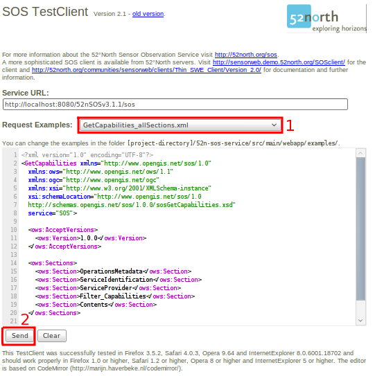
Fig. 1: 52°North SOS test client - welcome page

  1. To get started with the SOS, select the GetCapabilities_allSections.xml [1] request from the drop down list next to “Request Examples”.
  2. Push the Send button [2] and the request will be transmitted to the 52°North SOS. As result, a XML document is returned (see Fig. 2), which shows a the capabilities of the SOS (available data,...).
screenshot of 52°North SOS output - GetCapabilities response encoded in XML

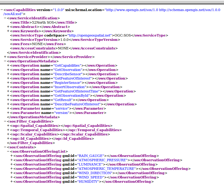
Fig. 2: 52°North SOS - GetCapabilities response (XML encoded)

  1. In Order to build your own requests you will need the capabilities of the 52°North SOS. Using this input, you can edit the provided requests by the test client. Just select them from the drop down menu.

Additional Information

user@osgeolive:~$ sudo /etc/init.d/tomcat6 status
* Tomcat servlet engine is running with pid 1234          <-- Tomcat is running
[...]
* Tomcat servlet engine is not running.                   <-- Tomcat not runing, so please start:
user@osgeolive:~$ sudo /etc/init.d/tomcat6 start
* Starting Tomcat servlet engine tomcat6           [ OK ] <-- Tomcat is running, now

Listing 1: Tomcat Status and Start (password for sudo: user)

  • The development of this version of the 52°North SOS was supported by the European FP7 research project EO2HEAVEN (co-funded by the European Commission under the under grant agreement n°244100):
EO2HEAVEN - Earth Observation and ENVironmental Modeling for the Mitigation of HEAlth Risks
© OSGeo Foundation and LISAsoft 2011... Disclaimer