

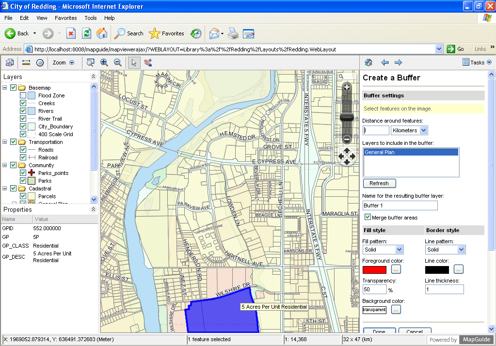
MapGuide Open Source is a web-based platform that enables users to develop and deploy web mapping applications and geospatial web services. MapGuide features an interactive viewer that includes support for feature selection, property inspection, map tips, and operations such as buffer, select within, and measure.
MapGuide includes an XML database for managing content. Maestro allows users to edit the XML database and build a website without writing a single line of code. MapGuide also supports most popular geospatial file formats, databases, and standards.
MapGuide can be deployed on Linux or Windows, supports Apache and IIS web servers, and offers extensive PHP, .NET, Java, and JavaScript APIs for application development. MapGuide Open Source is licensed under the LGPL.
Note
Due to space constraints, MapGuide is currently not installed on OSGeo-Live.
Interaktywne przeglądanie map
Wyjście kartograficzne
Build-in Resource Database for Manageability
data connections * Define data sources and layers once and use them in multiple maps * Access-based security model with inheritable permissions
Uniform Data Access
raster data * Provides a standardized way to access a variety of data sources including SHP, SDF, Oracle, MySQL, and PostGIS.
Flexible Application Development
Extensive Server-Side APIs
Szybka, skalowalna, bezpieczna platforma serwerowa
Wieloplatformowość
Strona internetowa: http://mapguide.osgeo.org/
Licencja: Mniejsza Powszechna Licencja Publiczna GNU (LGPL)
Wersja programu: 2.4.0 Pre-Release
Systemy operacyjne: Linux, Windows
Wsparcie komercyjne: http://www.osgeo.org/search_profile