

pycsw is an OGC CSW server implementation written in Python.
pycsw implements clause 10 (HTTP protocol binding (Catalogue Services for the Web, CSW)) of the OpenGIS Catalogue Service Implementation Specification, version 2.0.2. Initial development started in 2010 (more formally announced in 2011).The project is certified OGC Compliant, and is an OGC Reference Implementation.
pycsw allows for the publishing and discovery of geospatial metadata. Existing repositories of geospatial metadata can be exposed via OGC:CSW 2.0.2.
pycsw is Open Source, released under an MIT license, and runs on all major platforms (Windows, Linux, Mac OS X).
pycsw is installed by default on the OSGeo-Live DVD. This QuickStart will describe how to:
pycsw is written in Python, and works with (tested) version 2.6 and 2.7
pycsw requires the following supporting libraries:
Download pycsw the latest version or clone from GitHub:
$ git clone https://github.com/geopython/pycsw.git pycsw
Ensure that CGI is enabled for your install directory. For example, on Apache, if you setup pycsw in /srv/www/htdocs/pycsw (where your URL will be http://host/pycsw/csw.py), add the following to httpd.conf:
<Location /pycsw/>
 Options FollowSymLinks +ExecCGI
 Allow from all
 AddHandler cgi-script .py
</Location>
# easy_install or pip will do the trick
$ easy_install pycsw
# or
$ pip install pycsw
In order to install pycsw to an Ubuntu based distribution, one can run the following commands:
# sudo add-apt-repository ppa:pycsw/stable
# sudo apt-get update
# sudo apt-get install python-pycsw pycsw-cgi
In order to install the OBS package in openSUSE 12.3, one can run the following commands as user root:
$ zypper -ar http://download.opensuse.org/repositories/Application:/Geo/openSUSE_12.3/ GEO
$ zypper -ar http://download.opensuse.org/repositories/devel:/languages:/python/openSUSE_12.3/ python
$ zypper refresh
$ zypper install python-pycsw pycsw-cgi
For earlier openSUSE versions change 12.3 with 12.2. For future openSUSE version use Factory. Rolling version Tumbleweed is also supported. pycsw is included in the official Application::Geo repository of OpenSUSE Build Service.
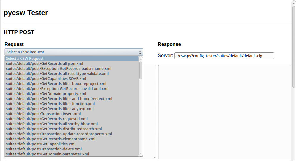
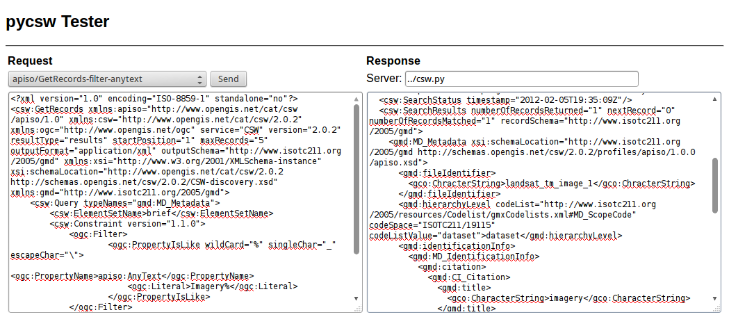
To run the pycsw tester, use the pycsw launcher from the Web Services group, or open Firefox and navigate to http://localhost/pycsw/tester/index.html:
By selecting the left drop-down list, the user can see various predefined POST requests, encoded as XML, that can be sent to pycsw:
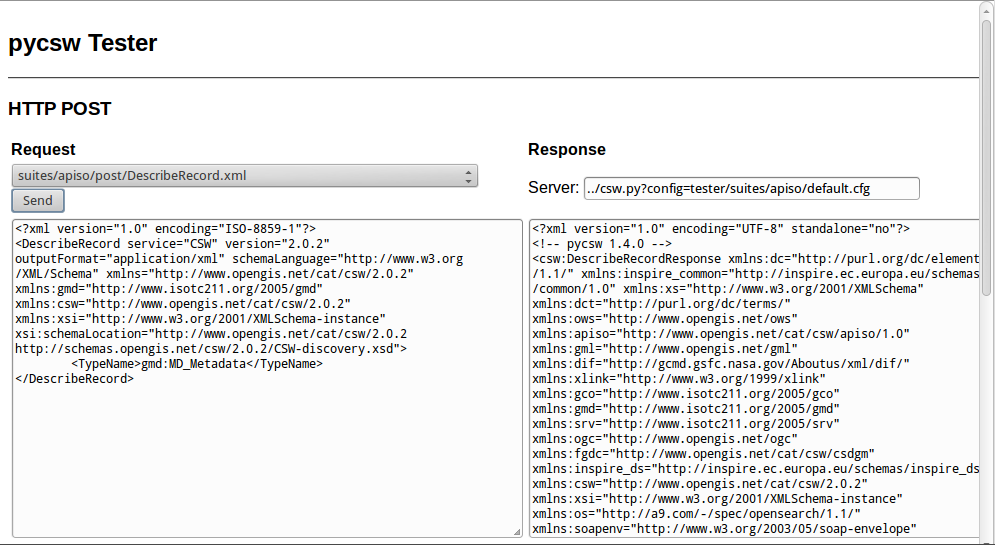
For example, by selecting “apiso/DescribeRecord”, and pushing the “Send” button, a description of the ISO Application Profile record is presented on the right panel:
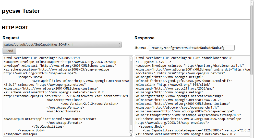
By selecting “GetCapabilities-SOAP” and pushing the “Send” button, a SOAP request is sent to the server to advertise their web service capabilities:
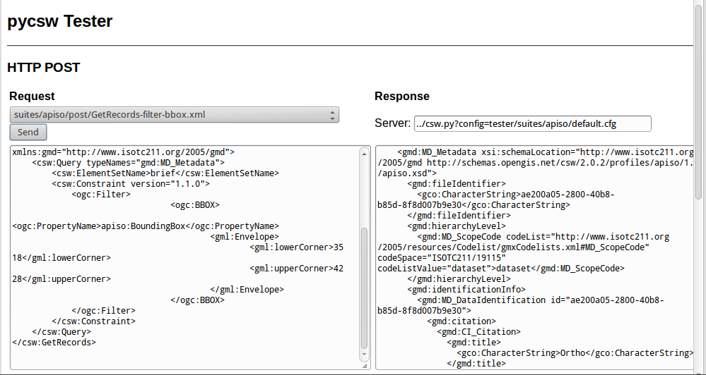
Also, the user can search for data records, performing a spatial bounding box query, by selecting “GetRecords-filter-bbox” and editing the coordinates in the XML request:
The user can go through all the available requests and perform various requests from this testing application.
The capabilities of the pycsw installation can be found at http://localhost/pycsw/csw.py?service=CSW&version=2.0.2&request=GetCapabilities.
To edit the web service metadata, included in the capabilities document, the user can modify the file /var/www/pycsw/default.cfg under the tag [metadata:main].
If the user wants to enable INSPIRE Discovery Service support, the metadata under the tag [metadata:inspire] has to be filled in and the enabled property has to be set to true.
For full functionality and configuration options, please consult the documentation on the pycsw website.
Metadata files for a spatial dataset or a spatial web service can be created through the open source implementation of inspire directive for metadata, European Open Source Metadata Editor (EUOSME). This application can be found at http://inspire-geoportal.ec.europa.eu/editor/. Source code is available at https://joinup.ec.europa.eu/svn/euosme/trunk
The user fills the mandatory metadata fields going through the application tabs, adding information like the name of the data owner, keywords, resource location on the web, geographic location (using a bounding box or the name of a country) etc.

After the user has added all the information available, must push the validation button on top of the page, so that a check to be performed for consistency with the INSPIRE directive.

After a sucessful validation, the XML file can be saved to the local disk and viewed through a text editor or a browser.
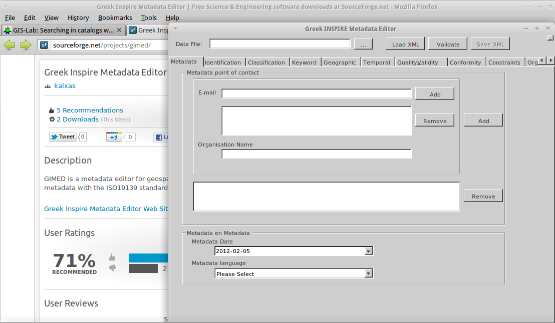
GIMED is a Free Software for creating and editing INSPIRE compliant metadata XML files. To install the application, use the following commands from a terminal:
$ wget http://downloads.sourceforge.net/project/gimed/GIMED_v1.3.0.tar.gz
$ tar zxvf GIMED_v1.3.0.tar.gz
$ mono ./GIMED_v1.3.0/bin/GIMED.exe
The user can follow the same workflow as in EUOSME to add and edit metadata, without the need for an internet connection.
pycsw supports the following databases:
In OSGeo-Live, a simple SQLite setup has been implemented. The database can be found in /var/www/pycsw/tests/suites/cite/data/records.db
In order to create a new SQLite database we need to:
[repository]
$ cd /var/www/pycsw
$ export PYTHONPATH=`pwd`
$ sudo python ./sbin/pycsw-admin.py -c setup_db -f default.cfg
This will create the necessary tables and values for the repository.
The database created is an OGC SFSQL compliant database, and can be used with any implementing software. For example, to use with OGR:
$ ogrinfo /path/to/records.db
INFO: Open of 'records.db'
using driver 'SQLite' successful.
1: records (Polygon)
$ ogrinfo -al /path/to/records.db
# lots of output
$ cd /path/to/pycsw
$ export PYTHONPATH=`pwd`
$ sudo ./sbin/pycsw-admin.py -c load_records -f default.cfg -p /path/to/records -r
This will import all *.xml records from /path/to/records into the new database and configure the repository to expose queryables as per Table 53 of OGC:CSW.
The HTTP request/response mechanism is not friendly enough to the end user in order to perform queries to the Catalogue Service. For this tutorial, we will use the QGIS OGC Catalogue Service Client plugin.
To install the plugin in OSGeoLive:
$ cd /usr/share/qgis/python/plugins
$ sudo svn co https://qgiscommunitypl.svn.sourceforge.net/svnroot/qgiscommunitypl/python/plugins/qgcsw/trunk/ qgcsw
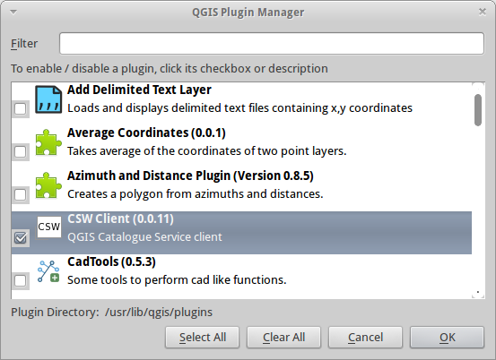
Start QGIS from the Desktop GIS group and go to “Manage Plugins”
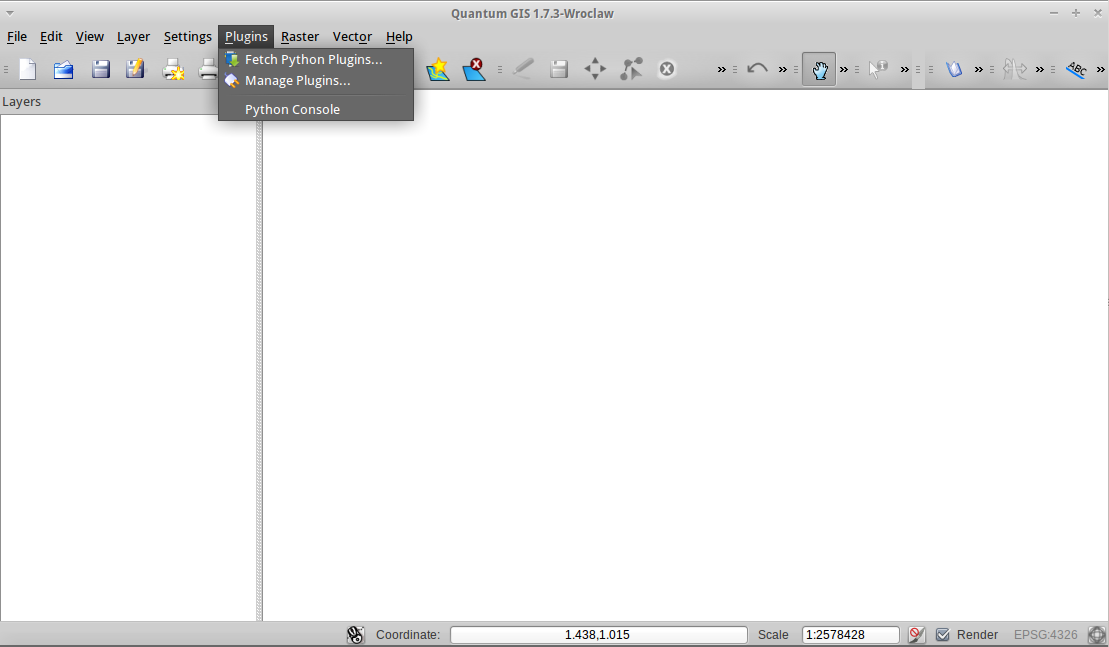
Enable the CSW plugin from the list
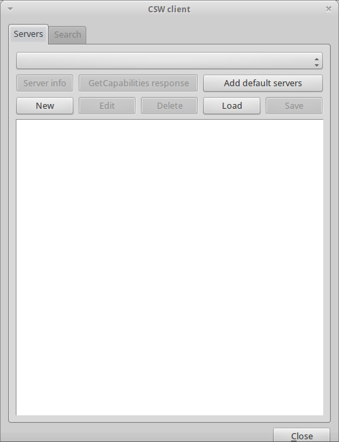
Then select the CSW button from the toolbar and launch CSW Client
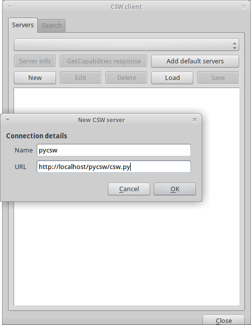
Add the pycsw server by pressing the “New” button and type in http://localhost/pycsw/csw.py
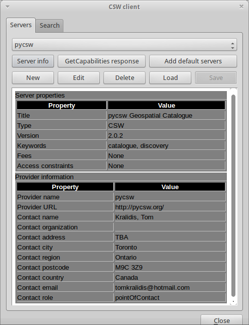
The user can add some default servers using the “Add default servers” button and also get the capabilities of the server using “Server info” button
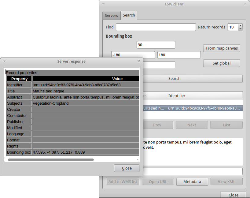
Perform search using the catalogue, either by a string value or with a bounding box
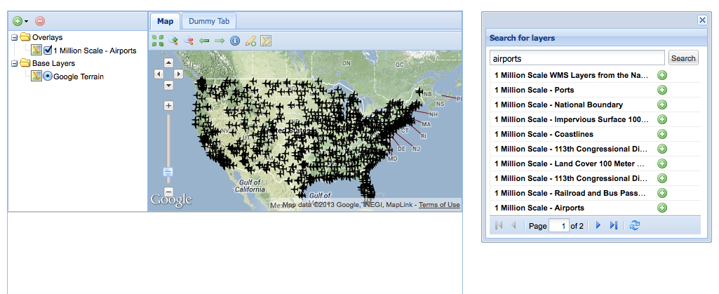
Another way to use a pycsw server is through a web application, acting like a CSW client. Such functionality is available through OpenLayers and GeoExt Javascript libraries.
For this tutorial we have hacked a small demonstration in GeoExt (thanks Bart van den Eijnden) using a demo pycsw installation at http://demo.pycsw.org/services/csw:
Discovery of data can be also performed through the Tester application by setting the appropriate requests eg. any text search with the string “imagery” leads to discovering the xml data created previously by EUOSME
For more information on pycsw, please consult the documentation on the pycsw website.