
The WPS standard provides rules for standardizing inputs and outputs (requests and responses) for geospatial processing services, such as polygon overlays and their inputs and outputs.
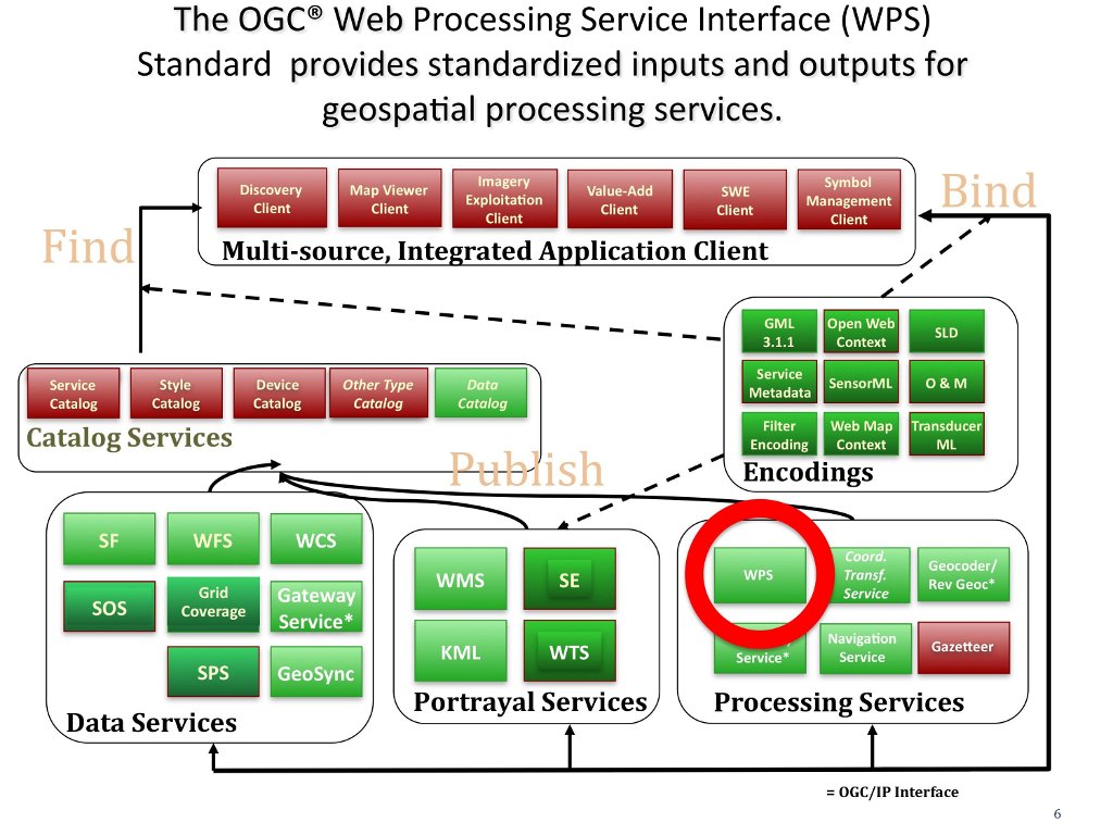
The OGC® Web Processing Service (WPS) Standard describes how to access geospatial processes from a web interface. Processes include any algorithm, calculation or model that operates on spatially referenced vector or raster data. A WPS may offer calculations as simple as subtracting one set of spatially referenced numbers from another (e.g., determining the difference in influenza cases between two different seasons), or as complicated as a global climate change model. (http://www.opengeospatial.org/standards/wps)
A WPS is particularly useful for:
Other OGC data service standards: