

QGIS Server Quickstart
QGIS Server provides a web map service (WMS) based on libraries from the QGIS desktop application.
This Quick Start describes how to:
- update an existing QGIS project and render it with QGIS Server
- create a new QGIS project and open the WMS directly in a browser
- Documentation:
Quick start for Server Installation on Debian/Ubuntu:
- apt-get install qgis-mapserver libapache2-mod-fcgid
- -> http://localhost/cgi-bin/qgis_mapserv.fcgi
- QGIS Web Client:
Start GeoExt viewer
OSGeo-Live contains an example of web map viewer based on the GeoExt Javascript framework and using QGIS Server for rendering the map.
- Click
You should see a browser window with a web map viewer showing a world map.
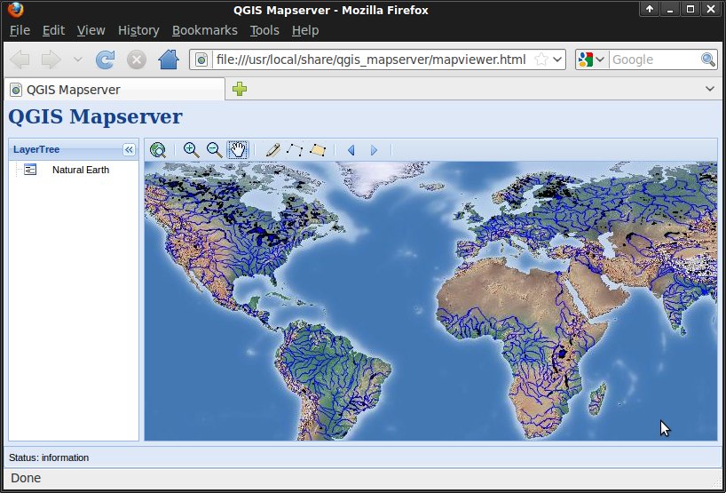
Alternatively, you can access the application using a browser through http://localhost/qgis_server
We will now change the map styling using QGIS.
Edit QGIS project
- Click .
- Choose from the menu bar.
- Select
QGIS-NaturalEarth-Example.qgsand press Open.- You should see the same world map rendered by QGIS. We will now change river styling and look at the result in the web map viewer.
- Double click
ne_10m_rivers_lake_centerlinesin the Layers tree. - Change the color in Outline Options to a different blue tone.
- Press OK.
- Rivers are now rendered in a new color.
- Save the project with .
- Reopen the web browser
- Zoom in
- You should now see rivers rendered in the same new color.
Create a new QGIS project
- Reopen QGIS
- Choose .
- Click .
- Browse to dataset
/home/user/data/natural_earth2/ne_10m_admin_0_countries.shp. - Press Open.
- You should see all world countries.
- Save the project with .
- Use file name
/home/user/world.qgsand press Save. - Open the WMS URL.
- You should see all world countries, this time rendered by QGIS Server.
What Next?
To learn more about QGIS Server, a good starting point is the QGIS User Guide.