
Cesium
About
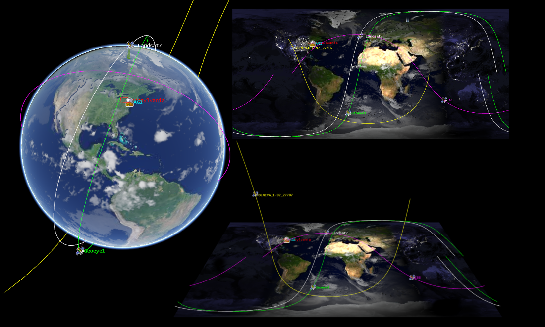
3D Globes and 2D Maps in a Browser
Cesium is a JavaScript library for creating 3D globes and 2D maps in a web browser without any plugins. It uses WebGL for hardware-accelerated graphics, and is cross-platform, cross-browser, and tuned for dynamic-data visualization.
Core Features
- Dynamic Geospatial Visualization:
- Built for Performance and Precision:
- Optimized WebGL with batching and culling efficiently uses hardware-accelerated graphics.
- Draw a wide range of geometries including polylines, polygons, billboards, labels, extrusions, and corridors.
- Use 3D Tiles to stream, style and interact with heterogeneous 3D data, including photogrammetry models, 3D buildings, CAD and BIM exterior and interiors, and point clouds.
- Control the camera and create flight paths.
- Use standard widgets to control animation time, select imagery layers, and zoom to a location.
- One API, Three Views:
- Cesium supports a 3D globe, 2D map, and 2.5D Columbus View with the same API.
Implemented Standards
- WMS and WMTS
Details
Website: http://cesiumjs.org
Licence: Apache 2.0 license
Software Version: 1.58
Supported Platforms: Platform independent, depends only on a browser which supports WebGL
Community Support: Forum at https://cesiumjs.org/forum/