
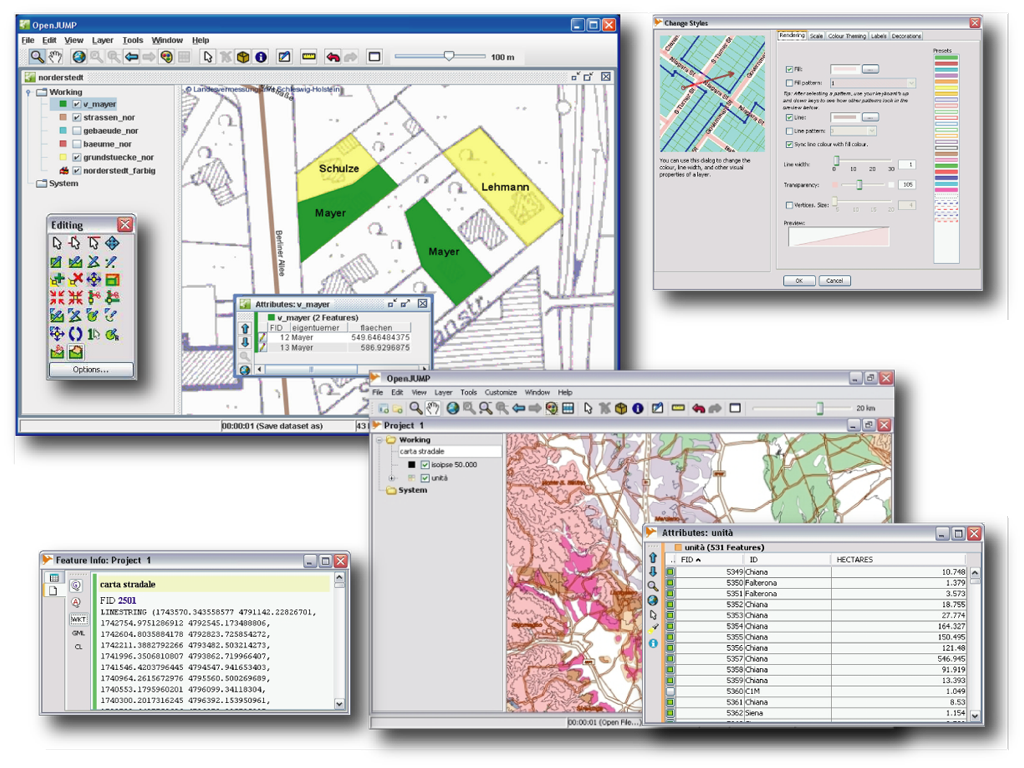
OpenJUMP is an easy to use and powerful deskstop GIS that enables users to edit, analyse, conflate, save and display geographic data. It is also an excellent framework for rapid prototyping to develop custom GIS functions.
Data Formats
- reads (files): GML, SHP, DXF*, JML, MIF* & TIFF, JPG, MrSID, ECW
- reads (DB): PostGIS, ArcSDE*, Oracle* and MySQL*
- writes: GML, SHP, DXF*, PostGIS*, JML & JPG
- supports: OGC WMS & WFS (-T), GML 2, SLD
- note that formats marked with a (*) come with an extra plugin
Editing & Conflation
- drawing points, lines, polygons, circles
- adding, moving, deleting vertices
- rotating, scaling, auto-complete polygon
- cut, merge, simplify polygons and lines
- warping, quality assurance tools*
(Vector) Analysis & Query
- spatial and attribute query functions
- calculating length, area, centroid, buffer, convex hull,...
- topology tools: line noder, polygonizer, planar graph,...
- attribute transfer tools (1:1 transfer, or n:1 transfer)
- raster analysis via SEXTANTE connector
Customization
- provides an API, scripting via BeanShell and Java Python
- (Java) plugin-system
Website: http://www.openjump.org
Licence: GPL
Software Version: 1.4.0.1
Supported Platforms: Windows, Linux, Mac, Unix
Community Support: http://www.openjump.org/support.html
Commercial Support: http://sourceforge.net/apps/mediawiki/jump-pilot/index.php?title=Professional_Support_Page